Back in March of this year I received the news I’d been dreading since moving to Tasmania, a loved one back in Ireland was gravely ill. That loved one was my mother and she had been diagnosed with incurable cancer. There was no hesitation that I’d travel to Ireland to be with her, my father and my brother. Getting there wasn’t going to be easy however, with a global pandemic raging and travel becoming a gamble at best and an absolute nightmare at worst.
The first hurdle was getting out of Australia and I had to request an exemption from the Australian Border Force to do that. I had read horror stories of people in the same situation being denied multiple times despite producing doctor’s letters and even death certificates. Thankfully Stephen from Border Force had a heart and granted my departure. Getting to Ireland was surprisingly straightforward with stops in Singapore and Amsterdam allowing me to avoid hotel quarantine upon arrival in Ireland. I still had to wait several days for my all clear PCR test before I could FINALLY hug my mum. I don’t think I’ve ever hugged anyone tighter.
I was scheduled to stay in Ireland for two months before attempting the return to Australia. Between days of sitting out in the garden with my mum or helping out around the house I caught up with friends who I had been missing greatly and hadn’t seen in quite some time. My passion for bushwalking is shared by many of my Irish friends, particularly my childhood chum Alan who suggested we climb Djouce on one of the days.
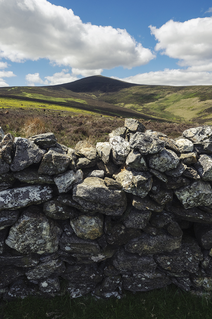
I have very fond memories of going up the Dublin mountains with my parents as a child, they’re up there with my most cherished memories so it was great to be heading back up as an adult on a much more adventurous route. Djouce mountain is 725m high, not exactly Everest but more than a Mole Hill at the same time. It’s famous as the site of a plane crash in 1946, when a former Luftwaffe plane carrying a group of French girl guides crashed in bad weather. Everyone miraculously survived and the epic adventure taken by the survivors to find help is the stuff of legend.
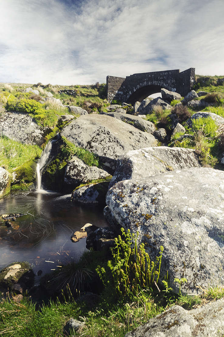
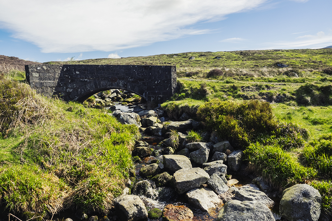
The drive up towards Djouce was lovely with sweeping views of the Dublin mountains and the occasional wooly traffic jam making for a fun journey. I stopped at a couple of bridges along the way and hopped about the rocks as the tannin stained streams trickled over and around them. Arriving at JB Malone carpark, we took the short detour across the road to check out the famous Lough Tay. We knew it as Guinness Lake growing up as it was part of the Guinness family estate. It’s also rumoured the family imported white sand and deposited it on one end of the lake so it looked like a pint of Guinness. I don’t think you could get much more stereotypically Irish than that haha. Children these days are far more likely to know it as Kattegat, the fictional town from the popular Vikings TV series. The sets are still there as part of filming the new spin-off series Vikings: Valhalla and there seemed to be plenty of infrastructure in place to support it.


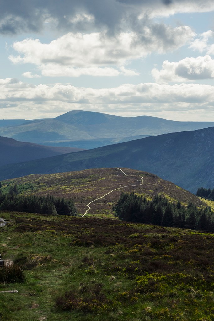
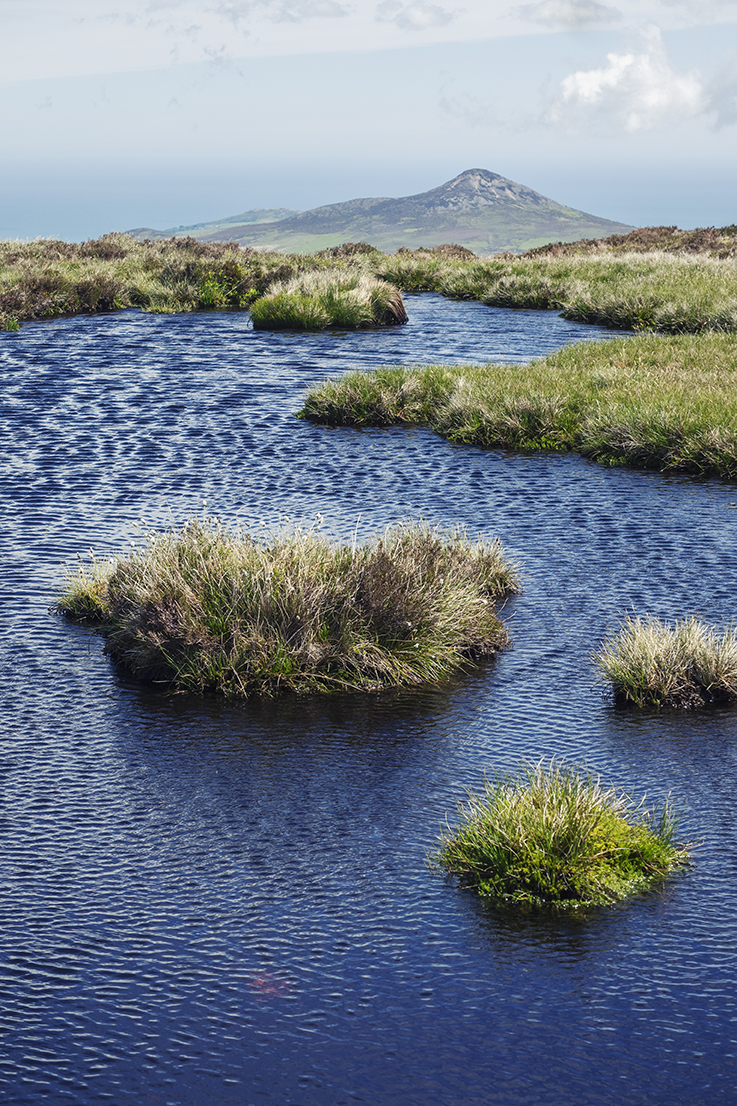
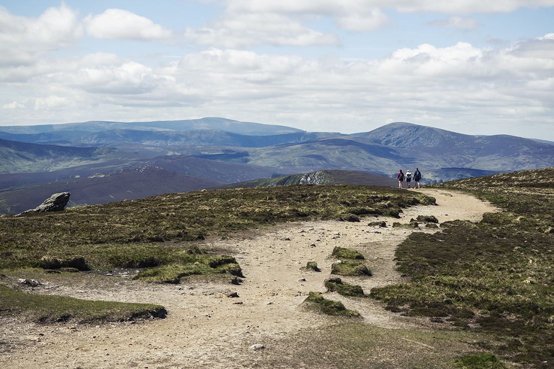
We ventured back across the road and commenced our journey up to the summit of Djouce. A small copse of planted fir trees gives way to that typical Irish alpine scenery of boggy moorland and low lying scraggly vegetation battered by the elements. The walk up to Djouce is largely completed on railway sleeper boardwalks, which helps explain the popularity of the walk for day trippers from Dublin.
It’s a bit of a longer drive than the summit of Mount Wellington in Hobart but the fact many Dubliners can say “I can see my house from here” is pretty damn cool if you ask me. That’s a bit a sad indictment of our modern urbanised world that being within an hour’s drive of a natural area is considered special. That’s the reality we live with though so we should still cherish the opportunity to get out there and enjoy it.
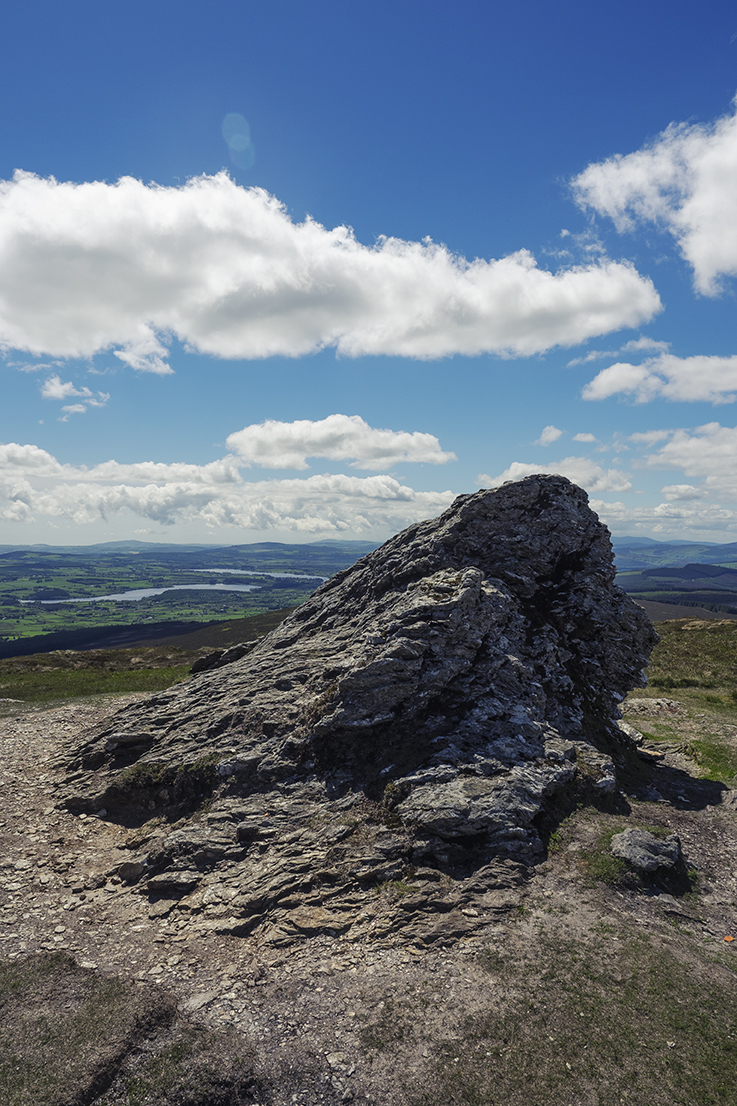
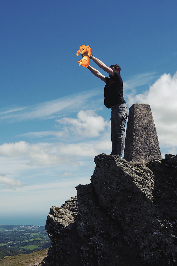
The summit is easily reached and the path to the top is plenty wide to allow ascenders and descenders to give each other room without having to step on any fragile boggy areas. The tippy top is marked with some large rocky outcrops that glisten in the sun due to their phyllite & schist composition. We stayed a little while on the summit, messing about and noticing the Pride Rock vibes before continuing on over the other side and down towards Powerscourt Waterfall.


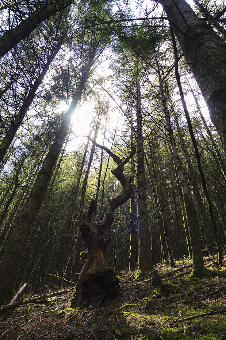
Djouce is located on the Wicklow Way, a 127km trail that takes you through some of Ireland’s most beautiful country and takes a week or so to complete. We were venturing along this route when I noticed a different signpost that seemed to be pointing more or less in the direction of Powerscourt Waterfall, Ireland’s highest and still a fair way below us. A quick look at a GPX trail app on my phone and I could see it led all the way down to the base of the falls. I convinced Alan that it would be a great idea to head that way and so we set off on our little detour. The path led us down and onto a steep hillside densely covered in falling and overgrown plantation forest.
We gingerly navigated our way down the trail, trying our best not to fall and impale ourselves on one of the many branches jutting out. Suddenly from behind us, we heard the sound of branches breaking and saw something looming towards us. It was a mountain biker fearlessly flying down the very trail we were carefully navigating our way down. He roared past us without much of a greeting and before we could blink he was gone. No doubt he had cursed our stupidity to be on a mountain bike trail, albeit a seemingly unused and not in the official guidebooks one.
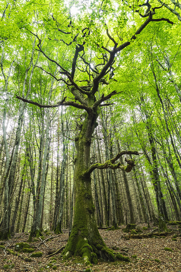
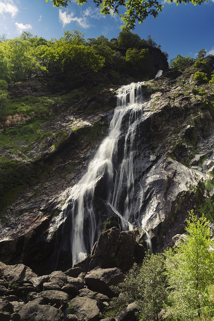
Eventually the slope got a little less treacherous and the forest took on a more pleasant shade of green as we neared Powerscourt Waterfall. A fence thwarted our ability to get closer to the falls but after a few hundred meters we were able to hop through a gap and onto the path leading away from the waterfall. The place was packed with tourists and we decided to sit on some tree roots overlooking the falls to have some lunch. A wedding party arrived to have their photos taken and being of a, shall we say less cultured and respectful persuasion promptly commenced throwing rocks at people who were taking selfies to clear the way for their precious images. Poor Alan was almost struck by a large rock while taking his drone out of it’s case for a spin. I’m so used to having entire mountains and beaches to ourselves in Tasmania, the circus came as a bit of a shock.
In all our fun and adventure of getting down to Powerscourt Waterfall, we neglected the fact that we’d have to get back up again….bugger. We contemplated the most direct route up the side of the falls but the myriad of warning signs combined with our respect for following the rules lead us to return the way we’d come. It was quite the slog back up the bike path but certainly worth it for the sense of adventure and accomplishment. The trip was a good distraction from the awful situation at home and made me appreciate the importance of spending time with friends and getting out to appreciate nature. You never know when those opportunities could be taken away from you.


Lovely memories James Fabulous photos too 😎🌺
Sent from my iPhone
>
What a beautiful part of the world. The forest is so neat unlike the messy Aussie bush. Loved the story and of course the sheep.